


Elwood Unincorporated Voting District, Box Elder County, Utah
About
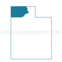
Outline

Summary
| Unique Area Identifier | 678440 |
| Name | Elwood Unincorporated Voting District |
| County | Box Elder County |
| State | Utah |
| Area (square miles) | 3.34 |
| Land Area (square miles) | 3.34 |
| Water Area (square miles) | 0.00 |
| % of Land Area | 100.00 |
| % of Water Area | 0.00 |
| Latitude of the Internal Point | 41.71691290 |
| Longtitude of the Internal Point | -112.13257330 |
Maps


Graphs
Select a template below for downloading or customizing gragh for Elwood Unincorporated Voting District, Box Elder County, Utah


Neighbors
Neighoring Voting District (by Name) Neighboring Voting District on the Map
- Deweyville Municipality Voting District, Box Elder County, UT
- Deweyville Unincorporated 2 Voting District, Box Elder County, UT
- Deweyville Unincorporated Fire Service District 1 Voting District, Box Elder County, UT
- Elwood Municipality Voting District, Box Elder County, UT
- Elwood Unincorporated Fire Service District 7 Voting District, Box Elder County, UT
- Elwood Unincorporated Fire Service District 8 Voting District, Box Elder County, UT
- Garland Municipality 1 Voting District, Box Elder County, UT
- Garland Unincorporated 1 Voting District, Box Elder County, UT
- Tremonton Municipality 1 Voting District, Box Elder County, UT
- Tremonton Municipality 2 Voting District, Box Elder County, UT
- Tremonton Municipality 3 Voting District, Box Elder County, UT
Top 10 Neighboring County Subdivision (by Population) Neighboring County Subdivision on the Map
Top 10 Neighboring Place (by Population) Neighboring Place on the Map
- Tremonton city, UT (7,647)
- Garland city, UT (2,400)
- Elwood town, UT (1,034)
- Deweyville town, UT (332)